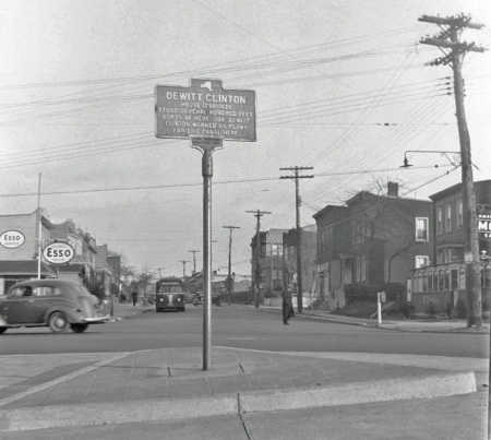
A historical marker near 56th Terrace and Maspeth Avenue that marked the former home of DeWitt Clinton, often referred to as the “Father of the Erie Canal.” (via Newtown Historical Society)
March 11, 2019 By Nathaly Pesantez
A local historical society has its sights on re-erecting a sign once located on a Maspeth intersection that marked the former home of a 19th-century politician widely considered to be the primary force behind the construction of the Erie Canal.
The Newtown Historical Society, founded more than a decade ago with the goal of educating the public on the former township (which includes present-day neighborhoods stretching from Maspeth to Forest Hills), is pushing to install a roadside historical marker at the intersection of 56th Terrace and Maspeth Avenue that indicated the former site of DeWitt Clinton’s home.
Clinton, born in 1769, served in the New York State Assembly and Senate before becoming mayor of New York City and eventually the sixth governor of the state in 1817. He championed the construction of the canal, which cuts across the northernmost section of the state, well before serving as governor, on the grounds that the project was essential to New York’s economic livelihood.
Plans for the ambitious canal, which was built between 1817 and 1825, were worked on in Clinton’s summer home in Maspeth, according to the historical society.
But the home, in the years after Clinton died in 1828, had switched hands and fallen into disrepair, eventually destroyed by a fire in the 1930s, according to a passage from “The Hidden History of Queens” provided by the society.
The historical marker was put up at the intersection some time after the fire, also in the 1930s, with the sign noting that Clinton’s home “stood several hundred feet north of here.” The marker also referenced the home’s connection to the Erie Canal.

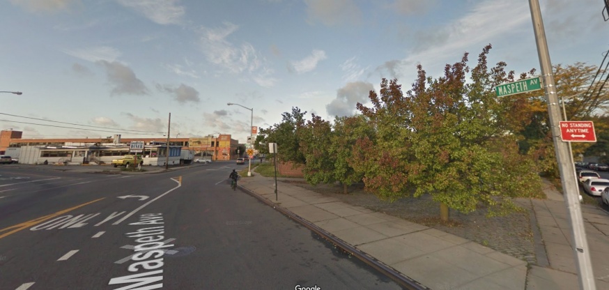
56th Terrace and Maspeth Avenue today. The sign is proposed to be installed at the triangular lot on the right of the image. (via Newtown Historical Society)
Decades later, the marker on the Maspeth corner was no longer in place.
“I believe when the road was reconfigured some time in the ‘50s or ‘60s, the sign disappeared,” said Christina Wilkinson, president of the historical society at last week’s Community Board 2 meeting.
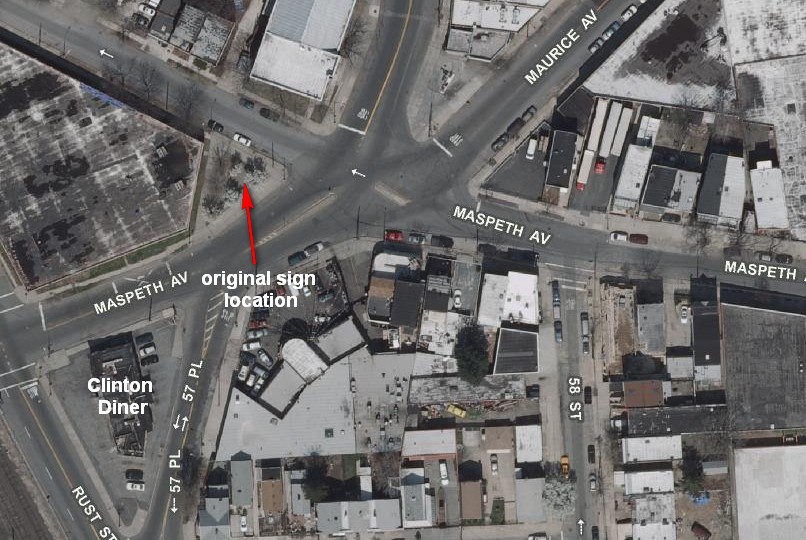
The group is now proposing to recreate the sign, inscription and all, and install it at the same site, which today is a Department of Transportation-owned triangular patch of land that is largely empty, save for some trees and grass.
Wilkinson said the society has already received pre-approvals from the DOT for the sign, but that the project needs to go before the city’s Public Design Commission, too, for approvals. The design commission, however, also requires that the proposed project be reviewed by the local community board prior to its own review.
Community Board 2, in its March 7 meeting, unanimously voted in favor of the project.
A timeline for the sign’s installation, once all approvals are received, is still unclear, but the historical society said the marker will likely cost around $1,100 to manufacture, with separate costs associated for its installation. The costs, however, are largely covered by a grant previously issued for the project by the City Council.

An aerial view of the proposed historical marker’s location. (via Newtown Historical Society)
One Comment


Who cares